
Introduction
Janes increases your awareness of the operational environment by providing open-source intelligence that supports threat and capability assessments, event analysis, change detection and equipment recognition. The interconnectivity of Janes data delivers unique insights and reveals previously hidden connections, bringing both visibility and accessibility to help you deliver a more robust intelligence product.
The case study that follows demonstrates how the connections between Janes data and insight across equipment and military capabilities enable you to quickly identify an unknown platform.
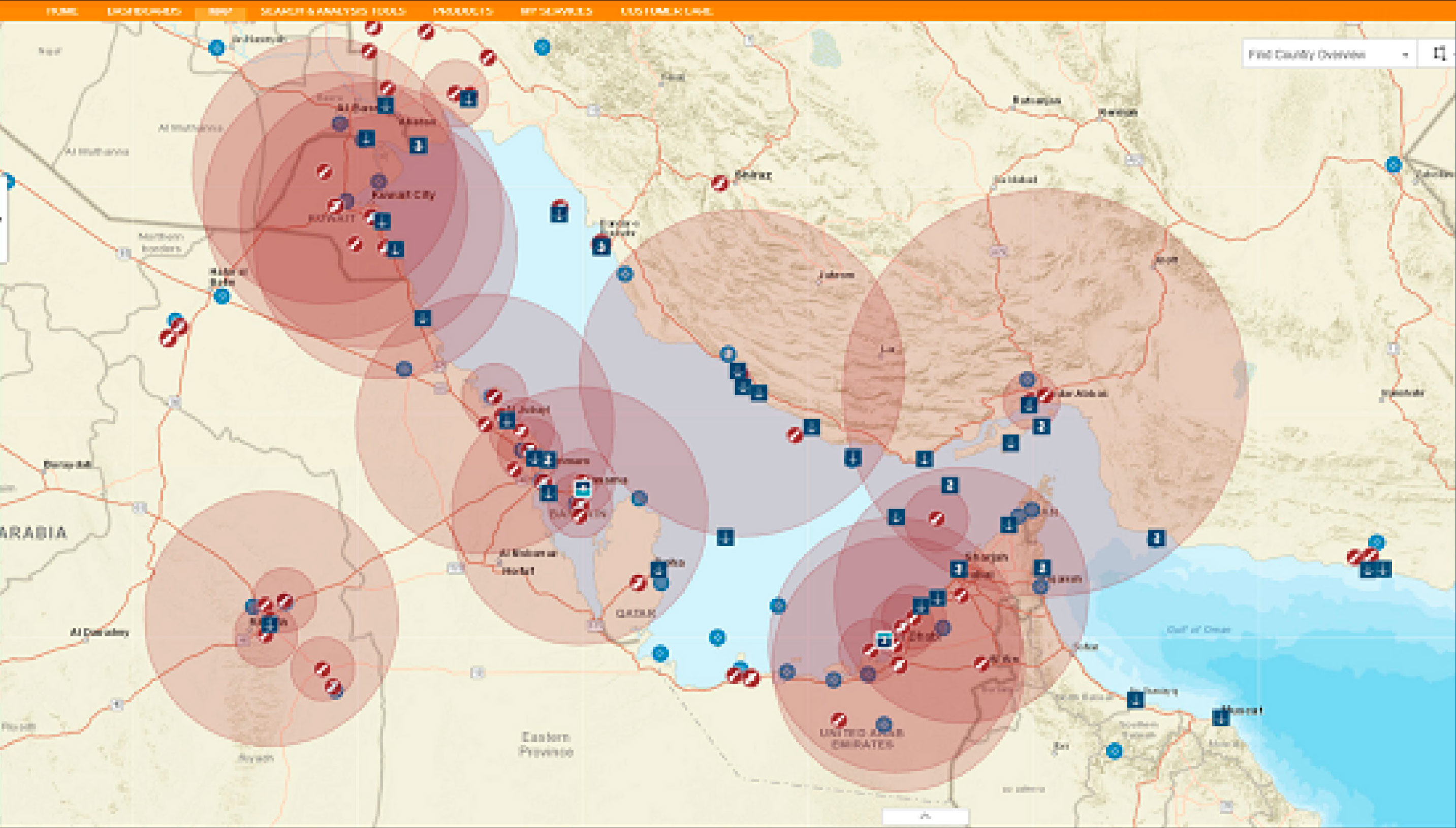
Geospatial layers that deliver rapid insight into your chosen area
Viewing the Janes order of battle and air defence data and insight as a geospatial layer enables you to maximise your visibility of a foreign entity’s capabilities and force structure.
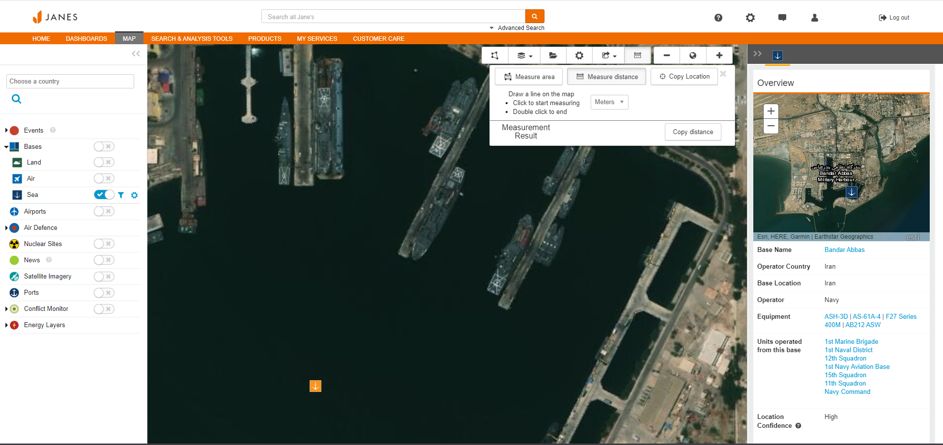
Supports platform recognition from overhead imagery
Multiple geospatial layers, including satellite base layer imagery, and map tools support capability assessment and platform recognition.
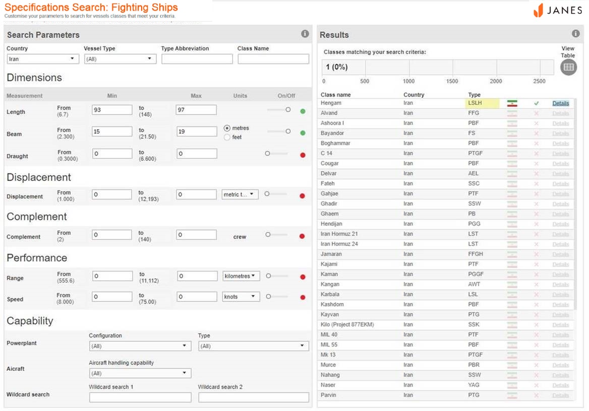
Specifications search support entity recognition
Powerful analytic tools enable you to use Janes specifications data to support entity recognition. By entering the beam and length measurements into the Janes Sea Specifications dashboard you will be given a list of sea platforms that fit the dimensions of the ship at Bandar Abbas. The data shows the ship is likely to be a Hengam Class Logistics Ship (LSLH).
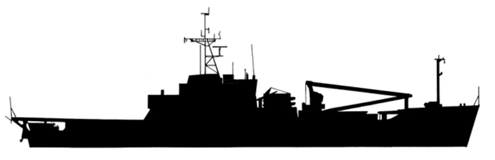
Detailed insight into military equipment to support entity recognition and capability assessment
With more than 41,000 profiles, Janes offers the only single resource for comprehensive, unclassified and up-to-date intelligence on military equipment (air, sea, land and space) in production and use around the globe. Janes delivers insight into platform families and variants, with verified and validated data on specifications, weapons and systems, inventories, images and related news and analysis. Using the military ship profiles and silhouettes of the Hengam Class Logistics Ship (LSLH) is the closest to the image from the map.
Using a combination of Janes content, quickly and easily identify an unknown platform.
- Geospatial layers deliver rapid insight into your chosen area.
- Specification data enables you to identify an unknown platform using approximate measurements.
- Detailed insight into military equipment to support entity recognition and capability assessment.